Beautiful maps tell compelling stories. Good data drives wise decisions. A GIS professional is an invaluable resource, and with 10 years experience in environmental GIS, our mission is to compliment the dedicated and painstaking work you invest in your work and reports. Your story deserves an elegant map to help paint a picture of how we can take steps towards environmental preservation, sustainable planning, and wise management of our cultural resources.
SierraGIS is a small, flexible, professional GIS consultant that provides exceptional geographic and geospatial services that can be tailored exactly to the schedule and budget needs of your projects. We specialize in environmental and culutural GIS applications, but can help you find a GIS solution for any spatial challenge. Above all else, we commit to bring integrity, honesty, and friendly service to every project and business relationship.
Disclaimer: All titles, names, places, measurements, and coordinates have been changed to protect client and project confidentiality.
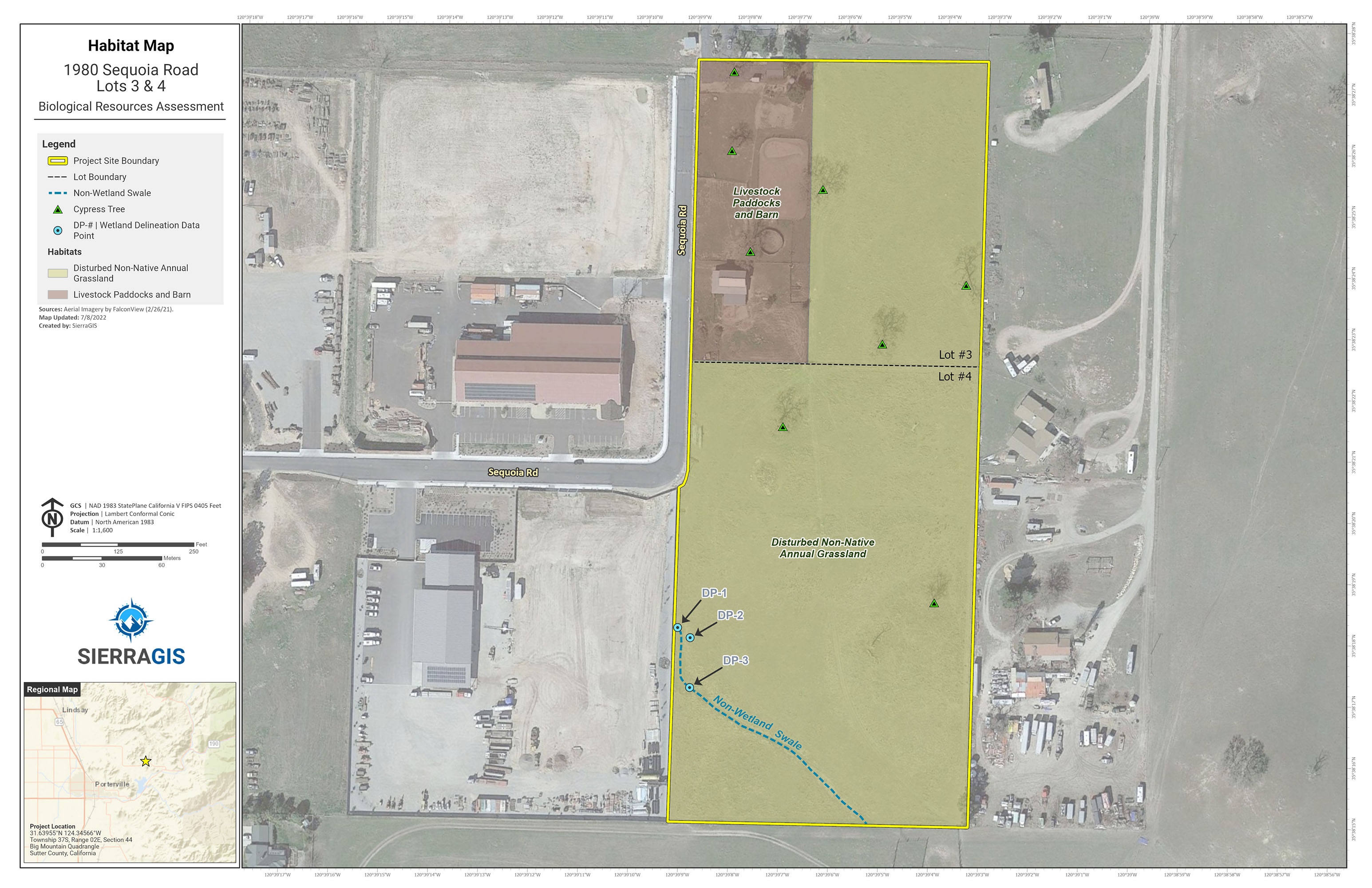
Habitat Map

Topographic Map
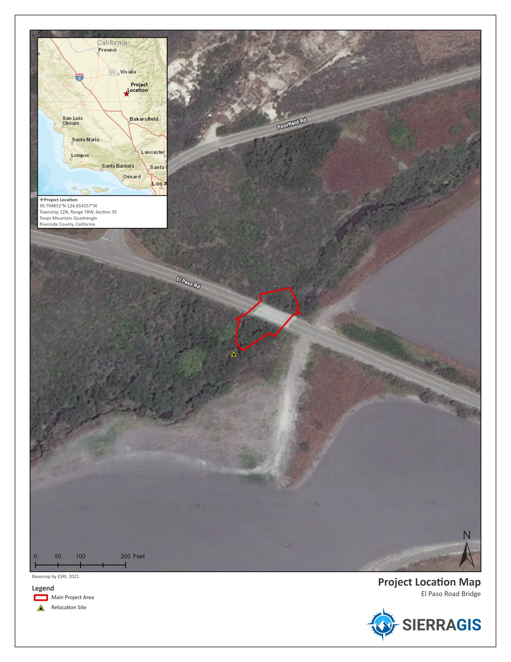
Project Location/Aerial Map
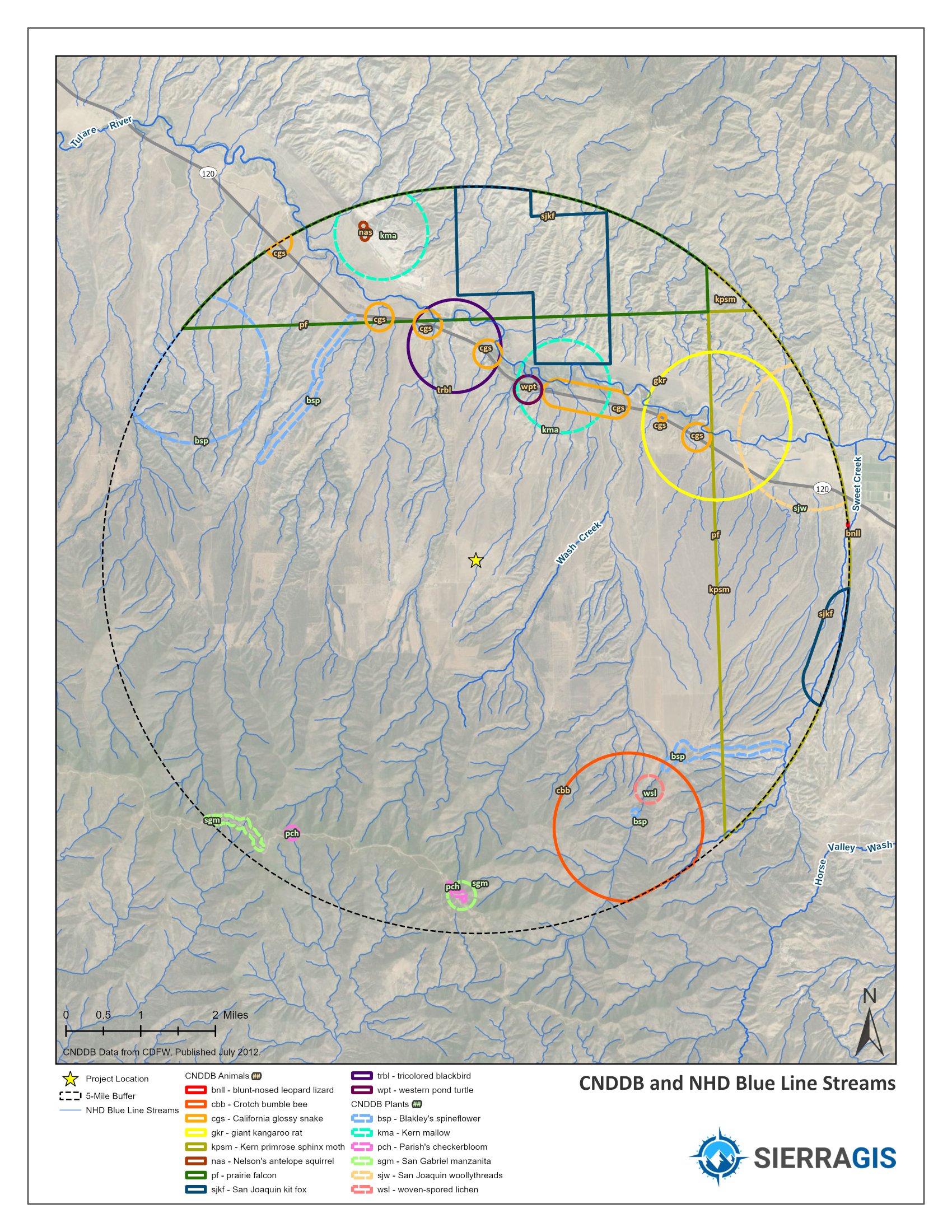
CNDDB Map w/ NHD
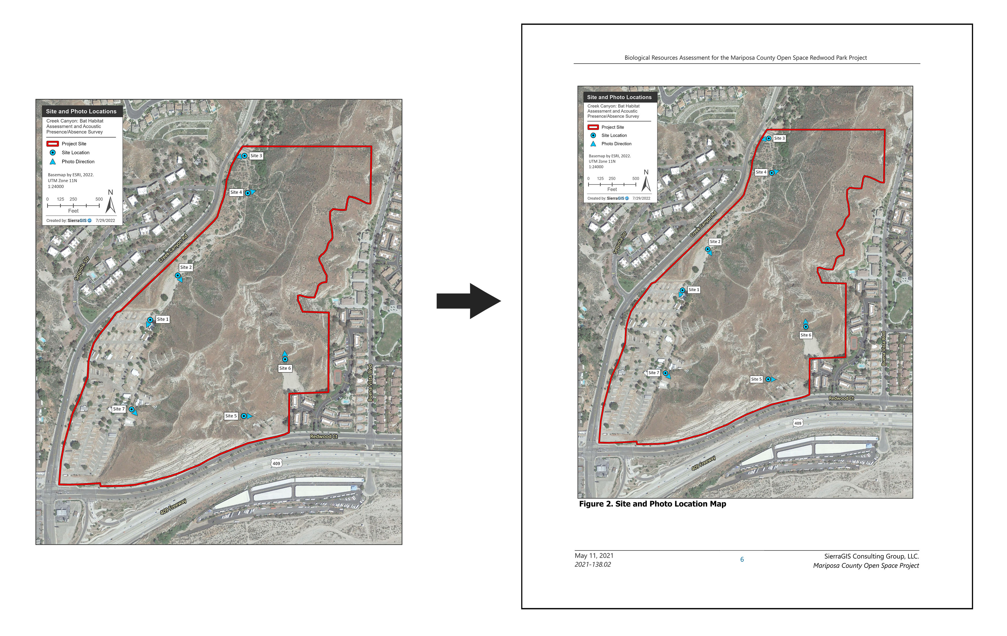
JPEG Drop-In: Site Photo Location
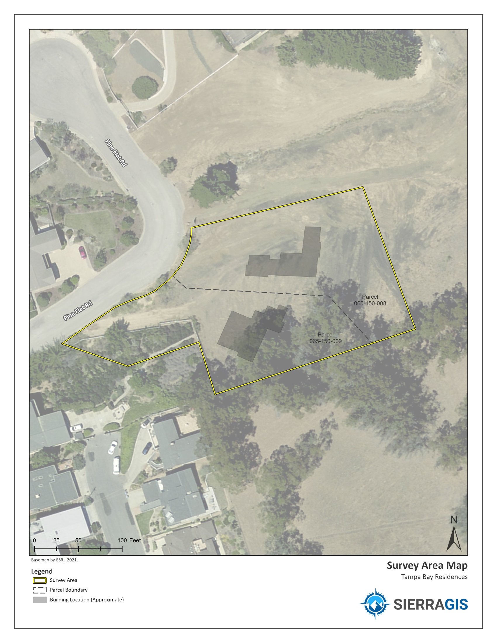
Survey Area Map
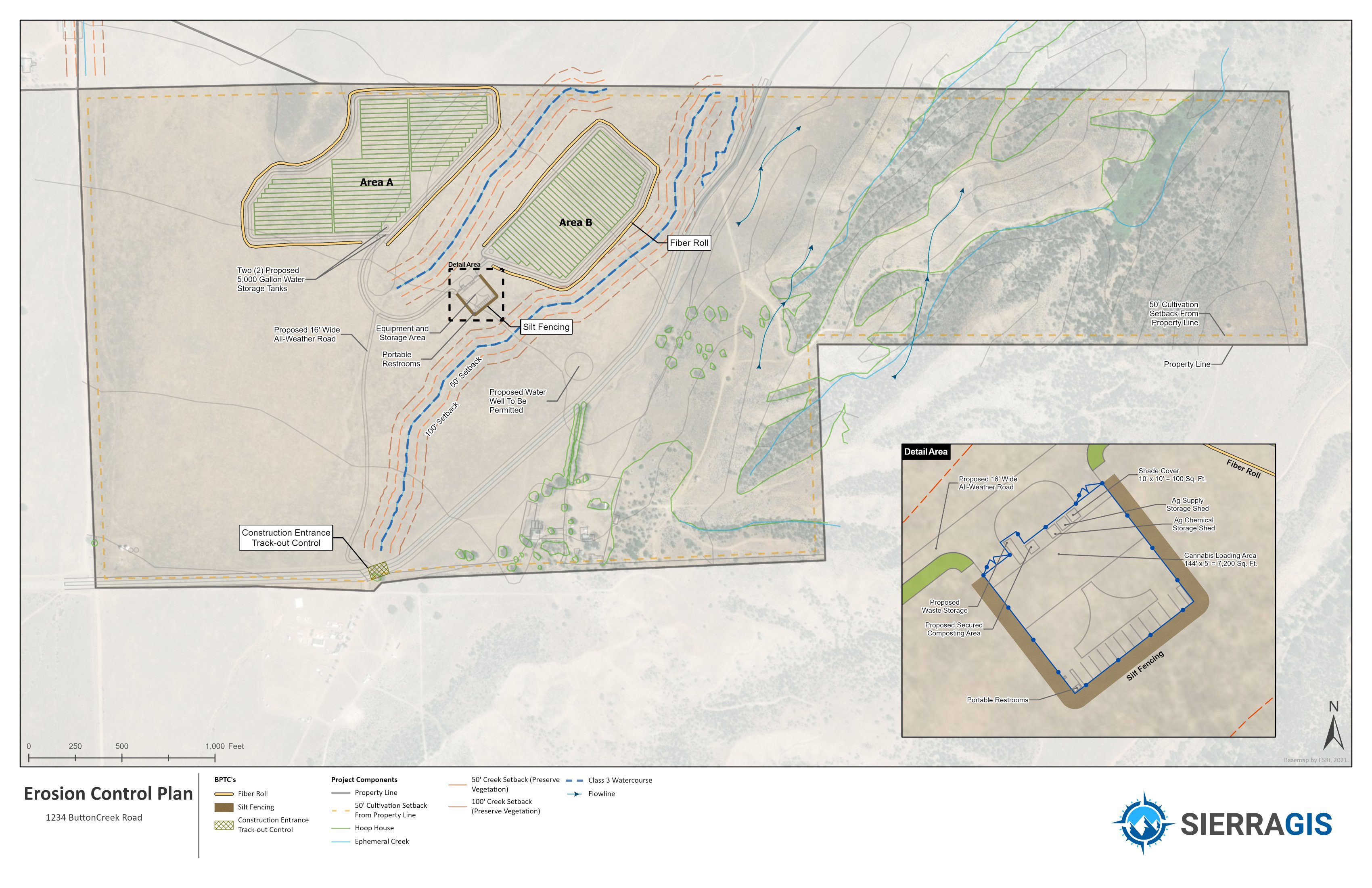
Erosion Control Plan
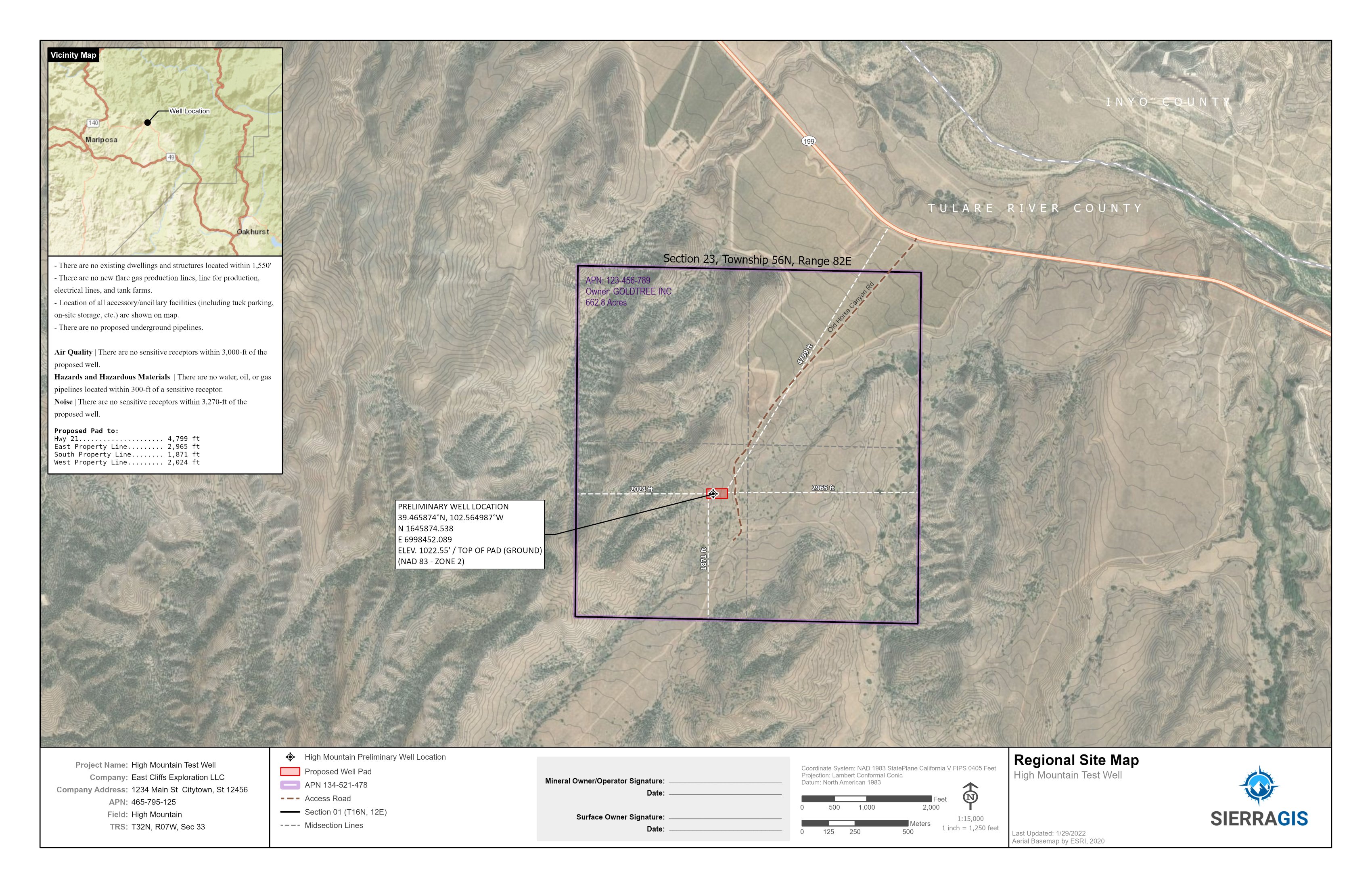
Oil Exploration Regional Map
Oil Exploration Detail Map
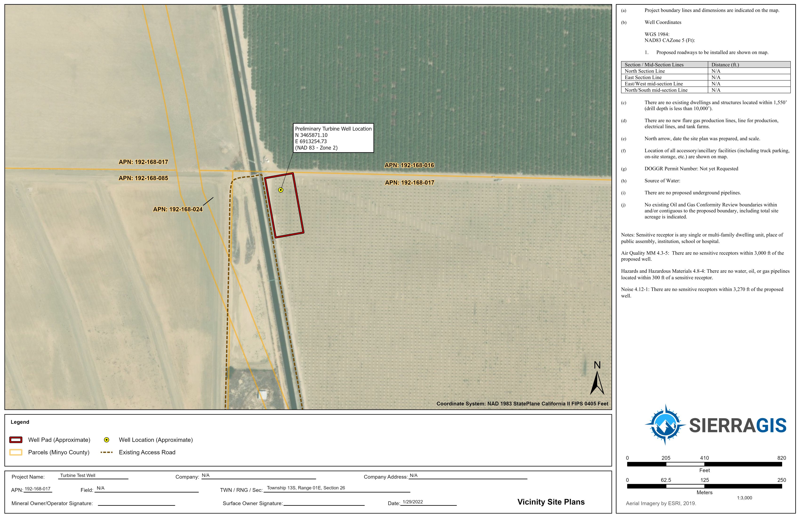
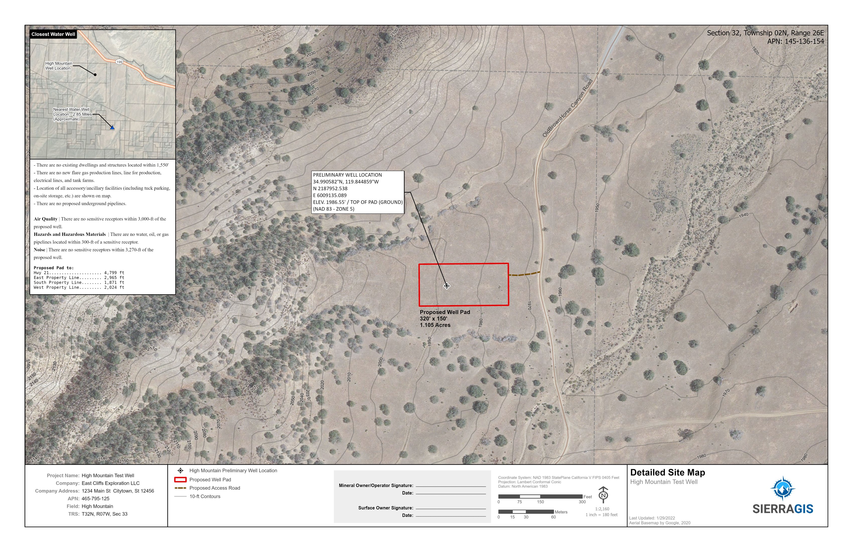
Oil Detailed Site-Map
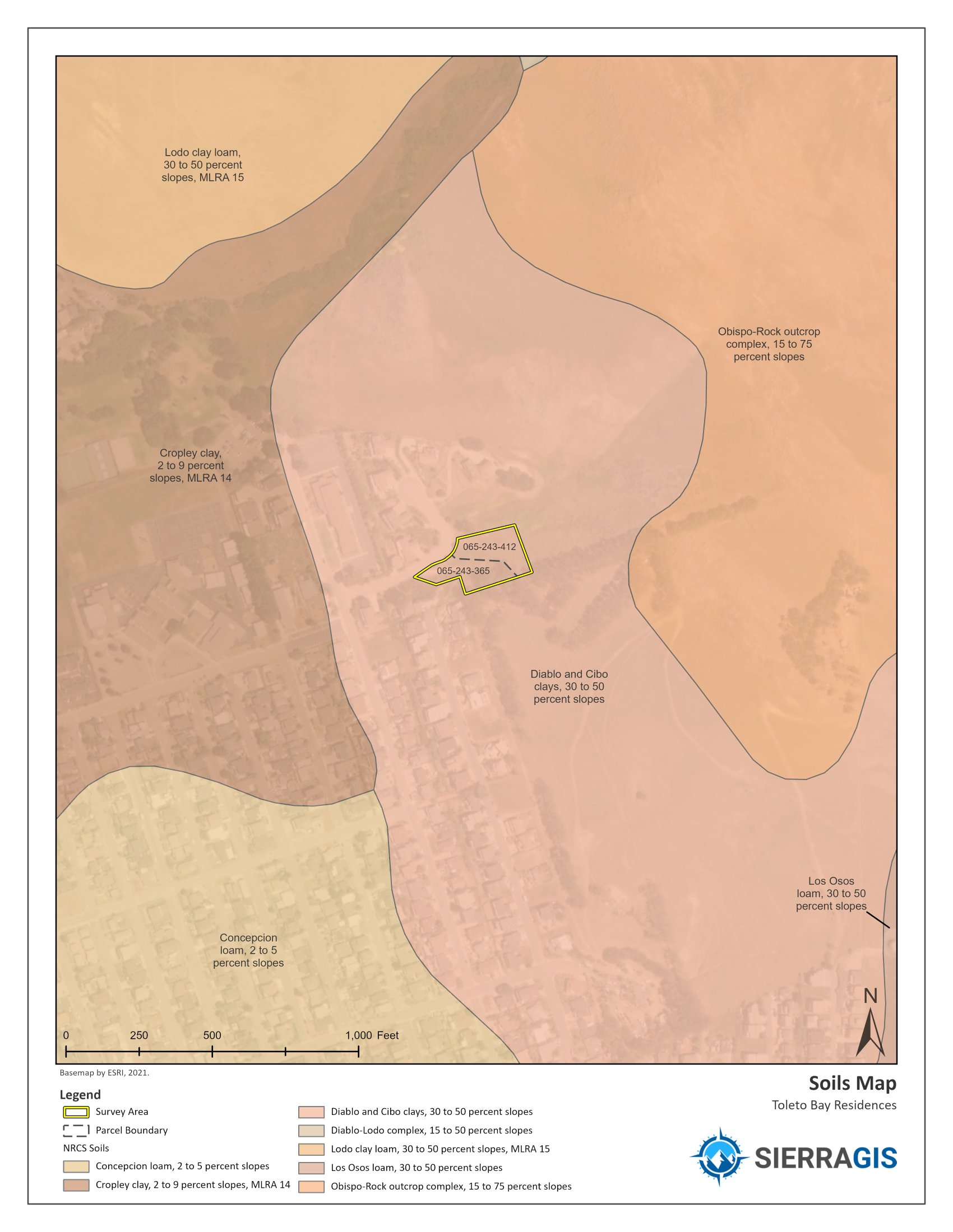
Soils Map
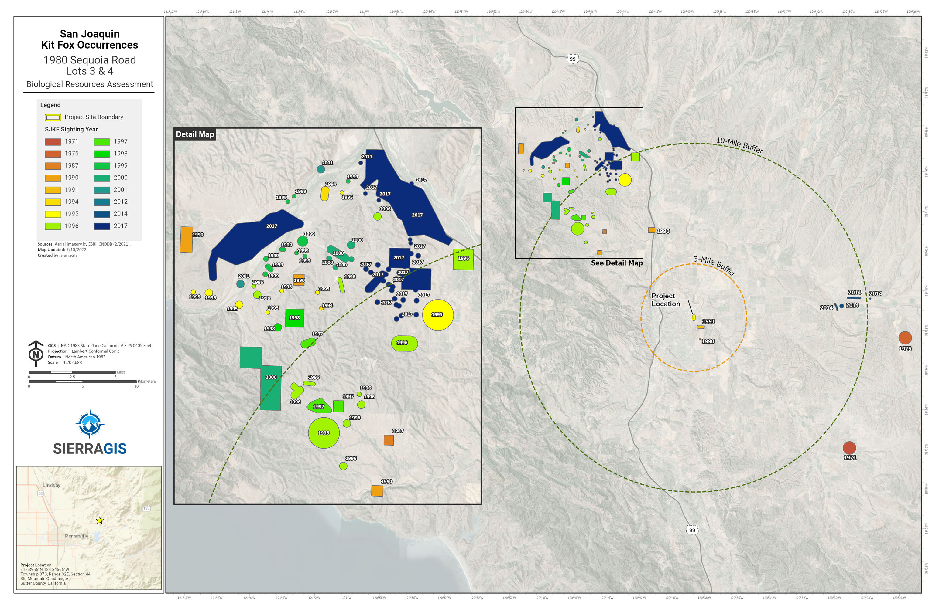
SJKF Occurence Map
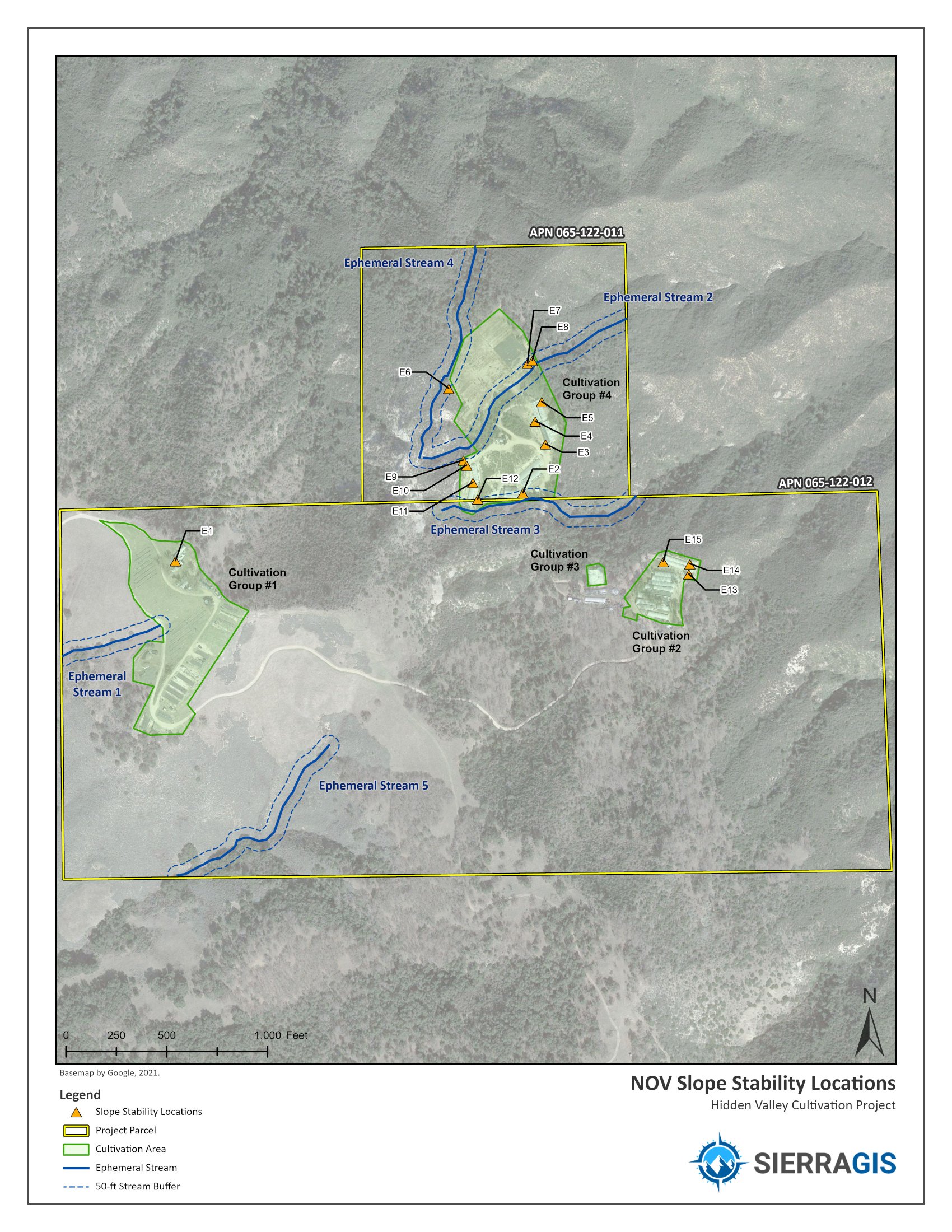
Slope Stability Map
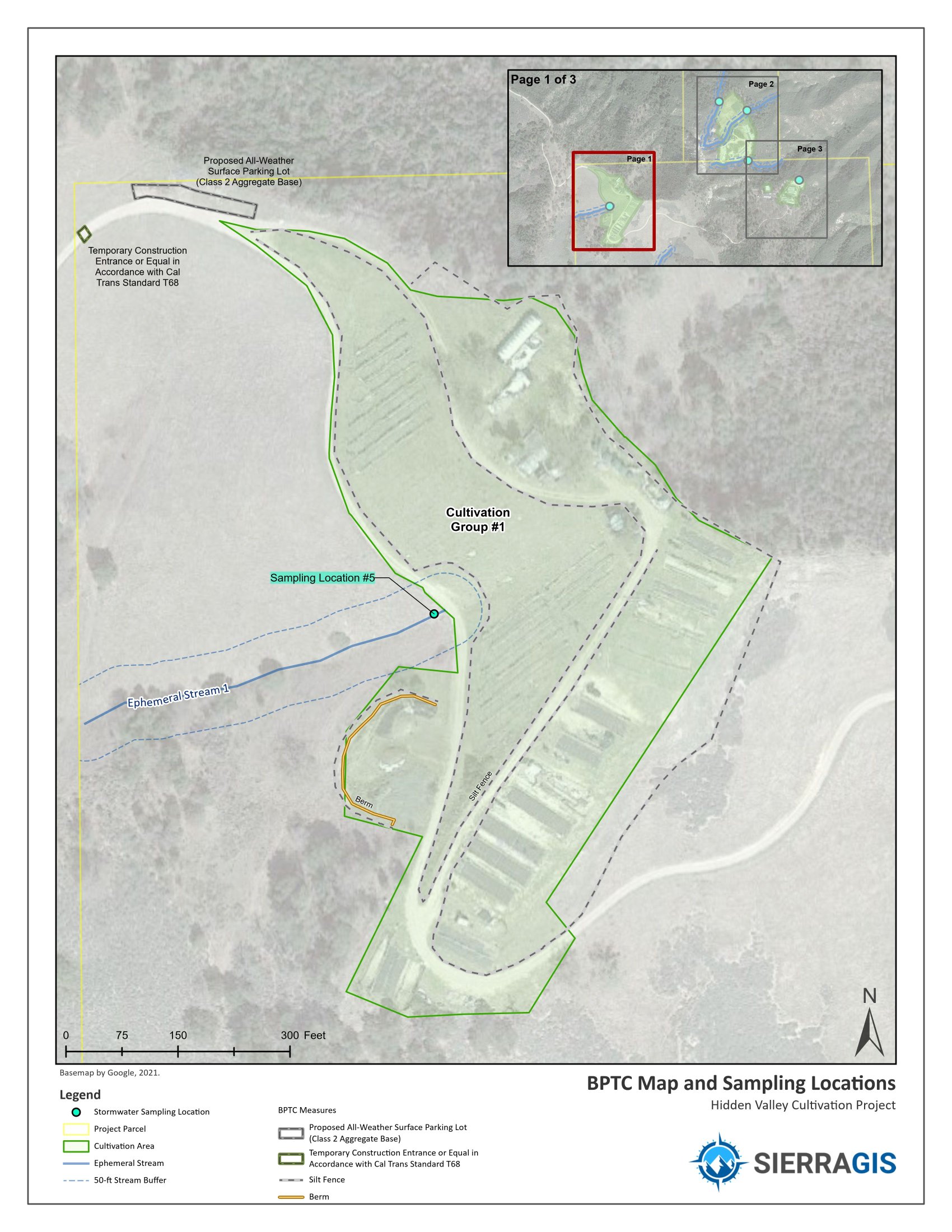
BPTC Mapbook Pg1
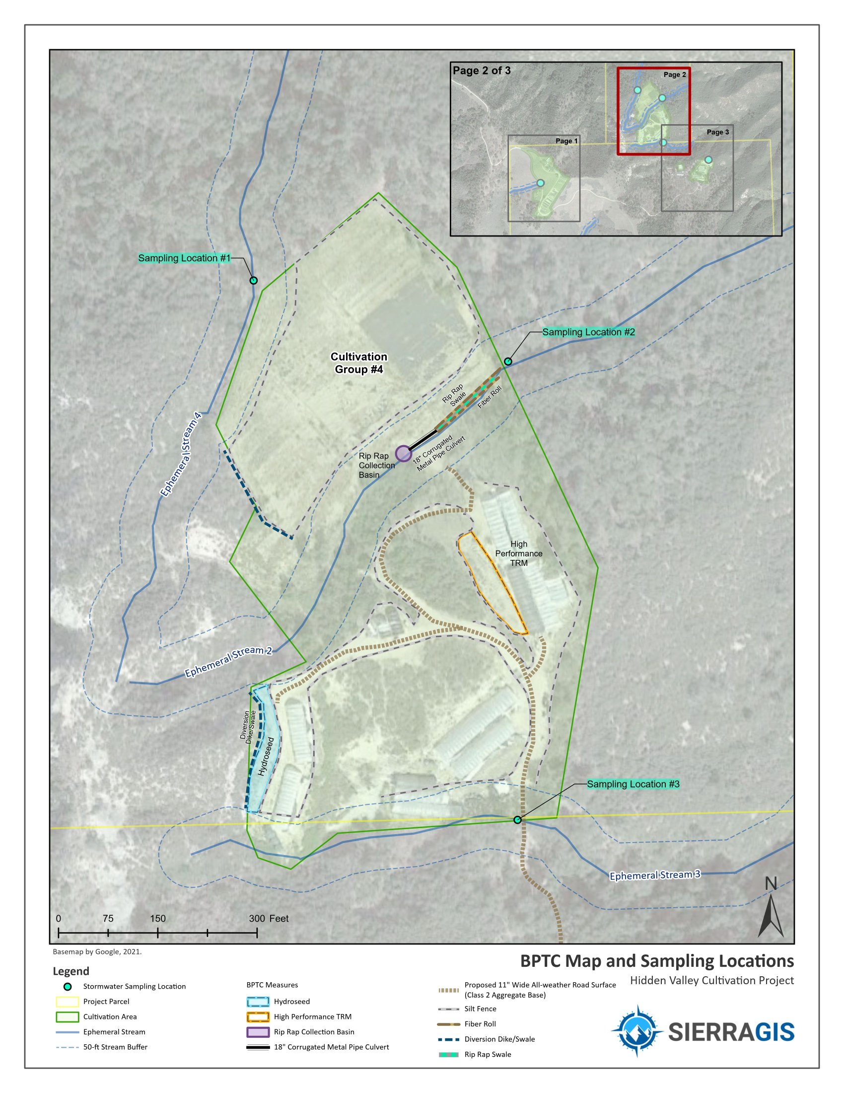
BPTC Mapbook Pg2
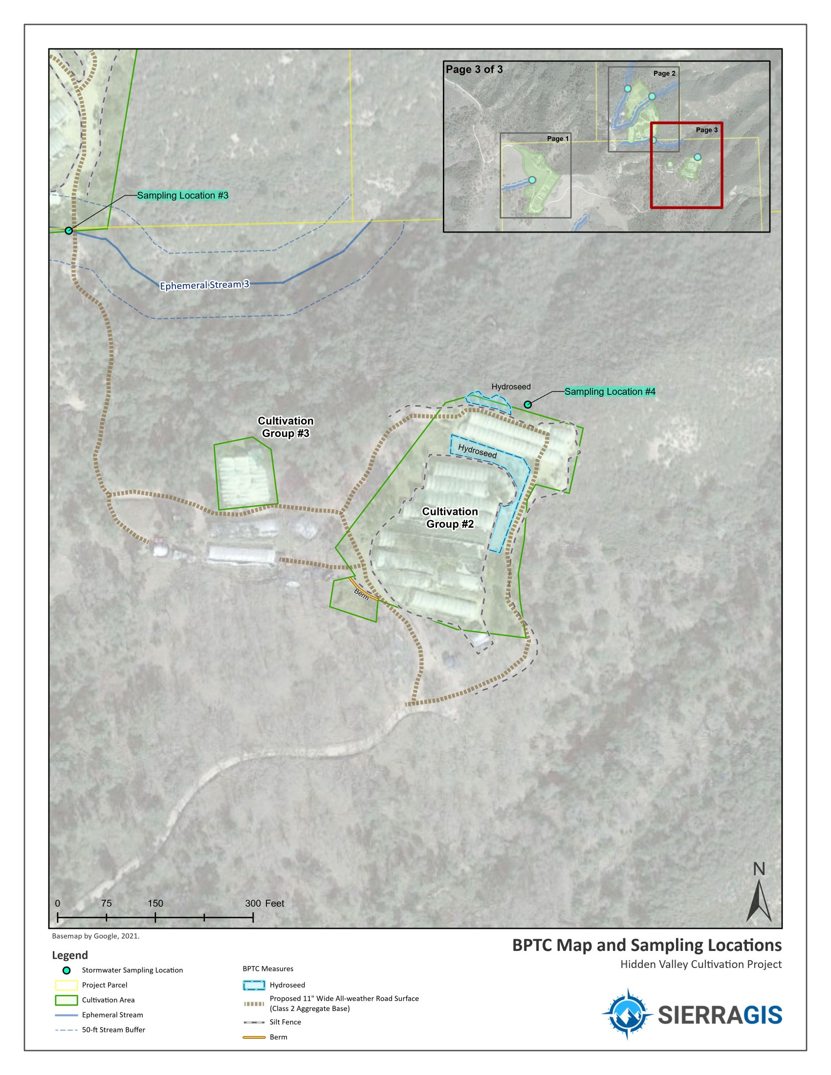
BPTC Mapbook Pg3
SierraGIS is headquartered in the beautiful central coast of California, and serve clients throughout Calfornia and in many surrounding counties including San Luis Obispo, Kern, Monterey, Santa Barbara, Tulare, Ventura, San Bernardino, Los Angeles and many more. From the Pacific Ocean to the Sierra Nevadas, SierraGIS has the local and regional environmental knowledge to bring you the best service.
Kevin Howen is the owner and founder of SierraGIS. His extensive GIS expertise comes from over 14 years of experience in the environmental consulting field, with additional GIS positions at an educational, county, and federal level. With experience ranging from field data collection operations, to leading a GIS team spanning the western US, Kevin is well prepared to be an exceptional and trusted GIS resource for your company.
See my LinkedIn Profile
| ☎ | 805-723-9980 |
| ✉ | info@sierragis.com |
We would love to hear from you!